Introduction: Why “Canadian Robotic Discovery Ocean Phytoplankton” Matters
Canada’s extensive coastline and legacy in marine research have led to the deployment of autonomous robotic platforms to explore the ocean’s hidden realms. These underwater robots carry sensors to measure chlorophyll, oxygen, pH, and other indicators of phytoplankton biomass, uncovering subsurface blooms invisible to satellites. The concept of Canadian robotic discovery ocean phytoplankton represents this innovative work, reshaping our understanding of ocean productivity and its role in the global carbon cycle.
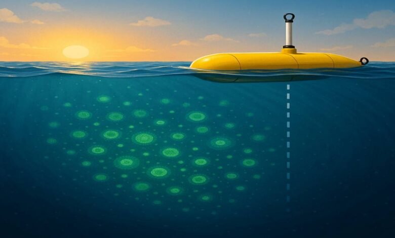
The Limits of Satellite Monitoring: Missing the “Hidden” Phytoplankton
Satellite maps surface chlorophyll effectively but are limited to the uppermost optical layer (around 20–30 m). Many phytoplankton communities thrive deeper, at nutrient-rich subsurface interfaces, evading detection. Cloud cover and satellite revisit intervals further reduce observation frequency. By complementing satellite data with autonomous robots, researchers capture a fuller three-dimensional picture of phytoplankton distribution.
Biogeochemical‑Argo Floats 101: How Canada’s Robots Dive Deep
Biogeochemical‑Argo floats are extensions of an international profiling network, each roughly 1 m long and 14 cm in diameter. They adjust buoyancy to dive and surface between depths of up to 2,000 m, carrying sensor suites including:
- Chlorophyll‑a Fluorometers for phytoplankton biomass estimates.
- Dissolved Oxygen Sensors to gauge photosynthetic and respiratory rates.
- pH and Nutrient Probes to assess carbon chemistry and nutrient availability.
At regular intervals, these floats transmit collected profiles via satellite, enabling continuous monitoring of ocean biogeochemistry.
Mapping the Invisible: Measuring Subsurface Phytoplankton with Robotics
Robotic floats provide detailed vertical profiles of physical and biogeochemical variables:
- Profiling Missions: Descents and ascents sample every meter, capturing fluorescence and backscatter data.
- Three‑Dimensional Mapping: Aggregating float data builds comprehensive maps of subsurface phytoplankton layers and deep chlorophyll maxima.
- Data Processing: Advanced algorithms correct for sensor quenching and calibrate backscatter to reflect cell sizes, improving biomass estimates.
This approach has revealed under‑ice blooms, transient subsurface layers in temperate regions, and seasonal deep chlorophyll maxima that satellites alone miss.
Key Findings: What Canadian Robots Have Revealed So Far
- Hidden Biomass: A significant portion of global phytoplankton biomass resides below depths detectable from space.
- Enhanced Carbon Export: Subsurface blooms contribute more to deep carbon sequestration than earlier estimates suggested.
- Under‑Ice Productivity: Early‑season phytoplankton blooms occur beneath ice, altering our view of polar ecosystem dynamics.
- Regional Variations: Intense deep chlorophyll layers are linked to seasonal mixing in temperate oceans.
- Biological‑Physical Interactions: Coupled sensors reveal daily cycles of photosynthesis and respiration, refining production estimates.
Impacts on Climate Science: Insights into the Global Carbon Cycle
Phytoplankton drive tens of gigatonnes of carbon uptake annually. Robotic observations have:
- Improved estimates of carbon export efficiency by revealing hidden pathways.
- Enhanced calibration and validation of satellite retrieval algorithms using in situ data.
- Provided three‑dimensional ground truth for biogeochemical models, improving future climate projections.
Collaborations Powering This Discovery
The success of Canadian robotic discovery ocean phytoplankton stems from coordinated efforts among national agencies, research centers, and academic teams across Canada. Joint deployments focus on strategic ocean regions, with interdisciplinary research groups developing new sensors, algorithms, and data assimilation methods. International partnerships ensure alignment with global monitoring priorities.
Overcoming Challenges: Data Gaps, Maintenance, and Scaling Up
Key challenges include:
- Sensor Drift & Biofouling: Ongoing work on coatings and automated cleaning systems.
- Data Latency: Efforts to streamline data transmission and processing.
- Operational Costs: Securing sustained funding for manufacturing, deployments, and data management.
- Harsh Environments: Designing floats to withstand extreme pressures and ice cover.
Innovations in quality-control algorithms and community partnerships support the expansion to hundreds of floats in Canadian waters.
The Future of Ocean Monitoring: Beyond Phytoplankton
Emerging directions include:
- Multisensor Integration: Adding imaging flow cytometers and DNA sequencers to profile community composition.
- Coupled Observatories: Integrating floats with gliders, moorings, and aerial drones for complete 4D ocean mapping.
- AI‑Driven Forecasting: Real-time data to predict harmful algal blooms and ecosystem shifts.
- Direct Carbon Measurements: Using sediment traps and optical sensors to refine carbon credit assessments.
These advances promise a holistic, autonomous ocean observatory that monitors physical, chemical, and biological dynamics year-round.
Conclusion: A New Era for Ocean Health Insights
The Canadian Robotic Discovery Ocean Phytoplankton Initiative heralds a new age in marine science. By unveiling subsurface phytoplankton and hidden carbon pathways, these robotic platforms enhance climate models, inform policy, and guide conservation. As networks grow and technology evolves, we edge closer to a continuous, global ocean monitoring system vital for understanding and protecting our blue planet.
FAQs
Q1. What are Biogeochemical‑Argo floats?
Ans: Autonomous platforms profiling down to 2,000 m with sensors for chlorophyll, oxygen, pH, and nutrients, transmitting data via satellite.
Q2. Why can’t satellites see all phytoplankton?
Ans: Satellite sensors detect only the upper tens of meters, missing deeper blooms obscured by light attenuation.
Q3. How do robots improve carbon cycle estimates?
Ans: They measure hidden subsurface blooms, revealing additional carbon export pathways not captured by traditional methods.
Q4. Where are these floats deployed?
Ans: In strategic ocean regions worldwide, with a focus on temperate, polar, and nutrient‑rich zones.
Q5. How is sensor accuracy maintained?
Ans: With specialized coatings, automated cleaning systems, and machine‑learning algorithms for drift correction.
Q6. What’s next for ocean robotics?
Ans: Integration of community‑composition sensors, real‑time AI forecasting, and scalable networks for global coverage.


